SAFE-CITIES Architecture

SAFE-CITIES has delivered a range of effective and innovative solutions to support the management and mitigation of security risks in public spaces. The SAFE-CITIES Platform enhances the assessment of security in public and semi-public areas, as well as at events. Additionally, our tools can assist in the design and improvement of existing, ongoing, and new public spaces.

Explore the Tools

SBS – Scenario Builder & Serious Gaming Simulator

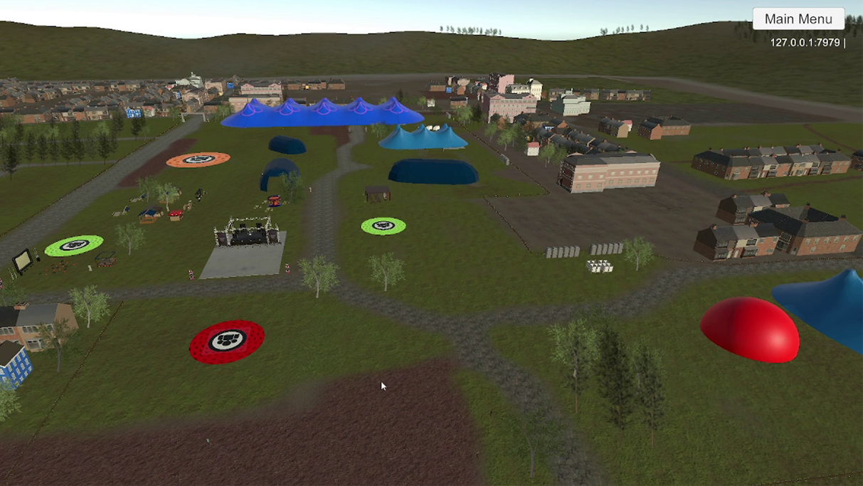
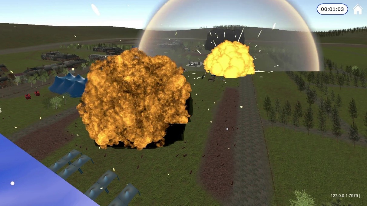
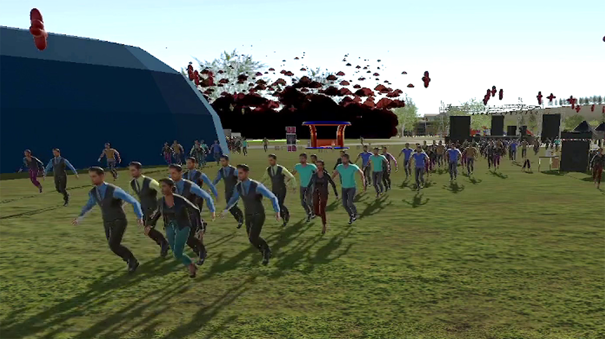
An advanced tool for creating 3D public spaces, populating them with crowds and security elements to immersively and collaboratively simulate complex security threat scenarios, particularly for large events and crowded spaces.

Scenario Builder
  • Create and configure threat scenarios using blueprint objects
  • Build a 3D environment
  • Import CAD, BIM, BFX model files
  • Configure sites with blueprint objects:
    • Static elements: security measures, urban furniture, etc.
    • Dynamic elements: citizens, security personnel, countermeasures, plot implementation items (exits), etc.
  • Design threat scenarios
    • Use blueprints and timelines to create personalised, complex plots
  • Deploy as a multi-player serious game
Serious Gaming Simulator
  • Advanced simulation of large events and crowded spaces
  • Multi-player training in an immersive serious game
  • Multiple players and roles (master, security officer, citizen, etc.)
  • Threat simulation
    • Various threats, including bombing, arson, stabbing, shooting, explosive drones, and abandoned bags
  • Human and crowd behaviour dynamics
  • Data-driven modelling and simulation
  • Supports VR immersive sessions

SERVE – SEcuRity Vulnerability assEssment

An innovative tool that enables users to assess the risk, impact, and attractiveness of any public space. This solution enhances and simplifies the security assessment of all public areas.

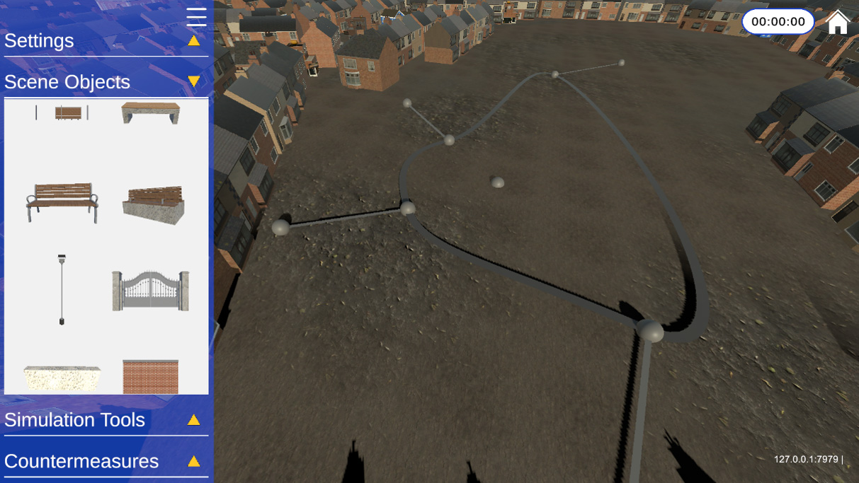
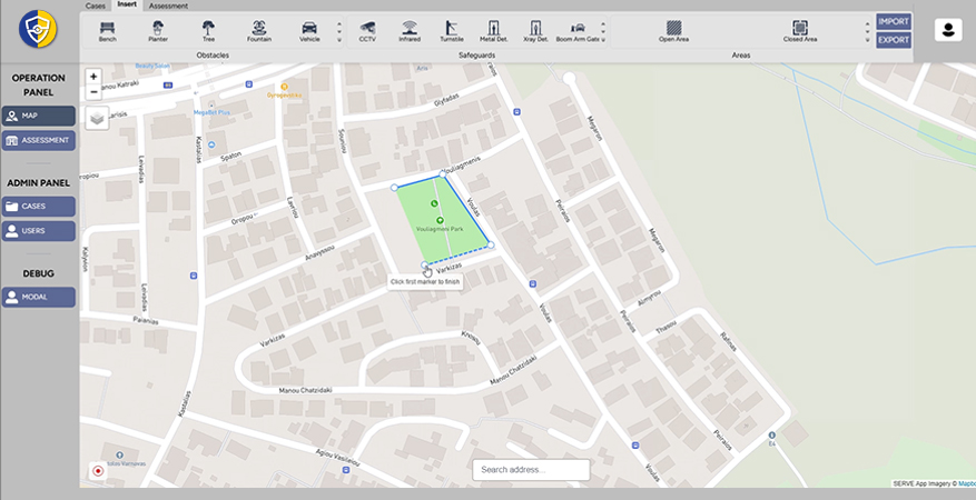
The SERVE tool allows users to visually mark public spaces on a map for assessment, specifying the exact areas they wish to evaluate. This spatial context is essential for accurate security analysis. Users can select threats from a predefined list, customising their security assessments based on the most relevant risks for the selected public space.

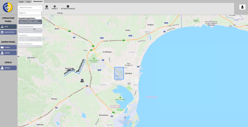
To evaluate the potential impact, risk, and attractiveness of a threat in a public space, a wizard guides users through a structured set of questions designed to determine the severity of the selected threat. Different question sets have been developed for each of these three calculations.

To ensure SERVE is both practical and effective, the development team has equipped it with a wide range of features, including support for data import and export, as well as the ability to add and edit security measures, obstacles, urban furniture, and surveillance systems.

SERVE Features
  • Comprehensive Security Assessments
  • Advanced Risk Scoring
  • User-Centric Visualisations
  • Broad Application
  • Security Measure Evaluation
  • Innovative and Accessible

The SERVE flyer is available under the following link.

SCoreboard

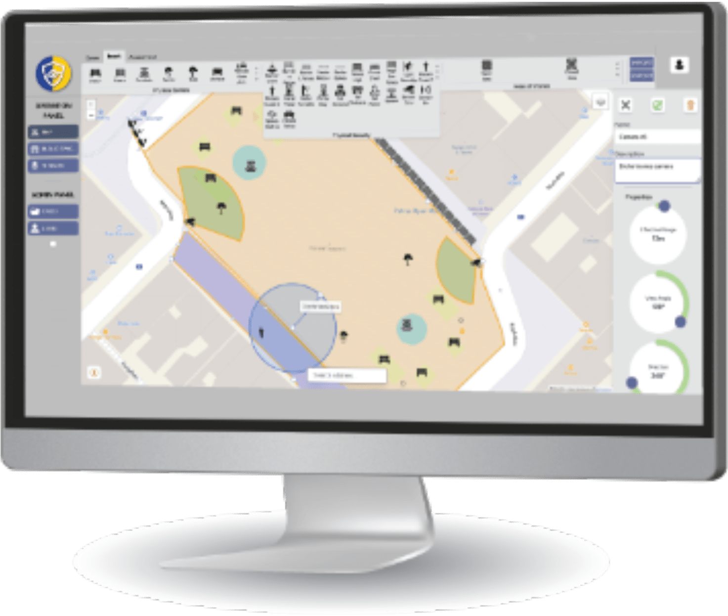
The tool reports simulation data and visualises it in an accessible and actionable way. It is UX-designed and enables easy presentation of results from different scenarios

Dispersion of Chemical, Biological, Radiological and Nuclear

D-CBRN is a complete framework for producing and processing high-resolution regional meteorological data, and utilizing them in computing complex transport, dispersion, chemical transformation, and deposition simulations. The model is suitable for both chemical and radiological dispersion of the framework. It uses statistical and/or dynamic downscaling in order to create high resolution data and a hybrid method for dispersion calculations.

Fire in Buildings

This is a model adapted from the NIST-FDS fire simulator and it is capable of predicting the environment in a multi-compartment structure subjected to a fire. It calculates the time-evolving distribution of smoke and gaseous combustion products as well as the temperature throughout a building during a user-prescribed fire.

T4S

T4S is a Safety and Security Management System that improves preparedness and supports situational awareness and decision making in cases of critical emergencies that require the partial or complete evacuation of a stadium/arena. The system will be improved to convey regulatory requirements, support the user in managing safety-related incidents and take into account the flow limitations of crowd movement.

Tab Content

This is a basic text element.

Impact

Improving security of public areas, critical infrastructure and soft targets

3D Visualisation of threats

Tools to improve the public spaces security

Improving communication before, during and after incidents

Critical situation management

Crowd behaviour management

Exploring ways of forces deployment

Supporting decision-making

Trainings for practitioners in public spaces security

Risk assessment

Providing threats scenarios

Identification of vulnerabilities and threats

Finding vulnerabilities of an infrastructure to an intrusion

Structuring Data Lake

Sorting out processes inside security forces

Mitigation of CBRN risks

Managing fire incidents in public spaces

Interested in the SAFE-CITIES Tools?

Contact Us

Tic box*
Copyright © 2025 SAFE-CITIES

Contact

SAFE-CITIES
(Risk-Based Approach for the Protection of Public Spaces in European Cities)
contact@safe-cities.eu
SAFE-CITIES has received funding from the European Union's Horizon Europe research and innovation programme under grant agreement No 101073945

Newsletter Form

Join the SAFE-CITIES newsletter to be updated with the recent news!
Checkbox*

Join the
Community

Join the SAFE-CITIES Community
Checkbox*